
龙潭区 topographic map
Interactive map
Click on the map to display elevation.
About this map
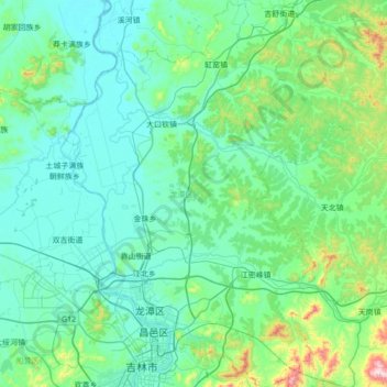
Name: 龙潭区 topographic map, elevation, terrain.
Location: 龙潭区, 吉林市, 吉林省, 中国 (43.80880 126.40833 44.30509 126.85461)
Average elevation: 840 ft
Minimum elevation: 538 ft
Maximum elevation: 2,867 ft
Other topographic maps
Click on a map to view its topography, its elevation and its terrain.