
桦甸市 topographic map
Interactive map
Click on the map to display elevation.
About this map
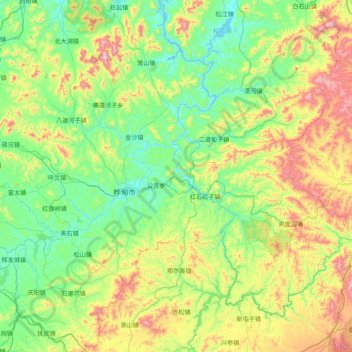
Name: 桦甸市 topographic map, elevation, terrain.
Location: 桦甸市, 吉林市, 吉林省, 中国 (42.55877 126.26937 43.48248 127.84663)
Average elevation: 1,657 ft
Minimum elevation: 801 ft
Maximum elevation: 4,528 ft
Other topographic maps
Click on a map to view its topography, its elevation and its terrain.