
前崴子 topographic map
Interactive map
Click on the map to display elevation.
About this map
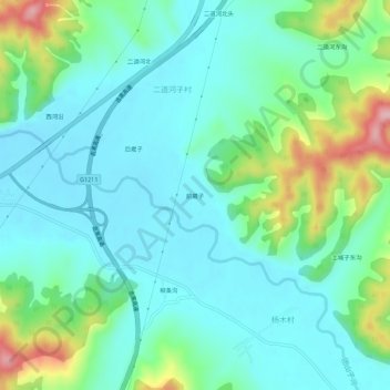
Name: 前崴子 topographic map, elevation, terrain.
Location: 前崴子, 龙潭区, 吉林市, 吉林省, 中国 (44.12702 126.63072 44.16702 126.67072)
Average elevation: 758 ft
Minimum elevation: 614 ft
Maximum elevation: 1,207 ft
Other topographic maps
Click on a map to view its topography, its elevation and its terrain.