
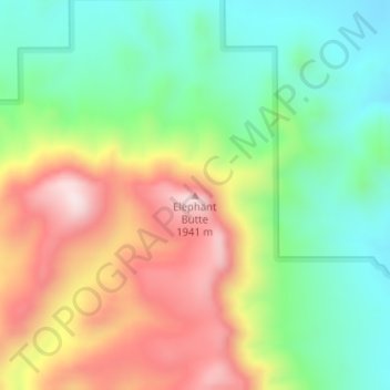
Elephant Butte topographic map
Interactive map
Click on the map to display elevation.
About this map
Name: Elephant Butte topographic map, elevation, terrain.
Location: Elephant Butte, Hidalgo County, New Mexico, United States (31.61116 -108.64954 31.61126 -108.64944)
Average elevation: 5,722 ft
Minimum elevation: 5,102 ft
Maximum elevation: 6,588 ft
New Mexico trails, hiking, mountain biking, running and outdoor activities
Other topographic maps
Click on a map to view its topography, its elevation and its terrain.
Bandelier National Monument
United States > New Mexico > Sandoval County
The monument is 50 square miles (130 km2) of the Pajarito Plateau, on the slopes of the Jemez volcanic field in the Jemez Mountains. Over 70% of the monument is wilderness, with over one mile of elevation change, from about 5,000 feet (1,500 m) along the Rio Grande to over 10,000 feet (3,000 m) at the peak of…
Average elevation: 6,988 ft
Taos Ski Valley
United States > New Mexico > Taos County
Taos Ski Valley is a village and alpine ski resort in the southwestern United States, located in Taos County, New Mexico. The population was 69 at the 2010 census. Until March 19, 2008, it was one of four ski resorts in America to prohibit snowboarding. The Kachina lift, constructed in 2014, serves one of the…
Average elevation: 10,594 ft
Capulin Volcano National Monument
United States > New Mexico > Union County
Capulin Volcano National Monument is a well-preserved, relatively young (55,000 to 62,000 years old), symmetrical cinder cone. It rises steeply from the surrounding grassland plains to an elevation of 8,182 feet above sea level. The irregular rim of the crater is about a mile in circumference and the crater…
Average elevation: 7,201 ft
Fort Sumner
United States > New Mexico > De Baca County
In the 1920s the Transcontinental Air Transport airline built an airfield in Fort Sumner as part of its coast-to-coast air passenger network, but the site was abandoned when the airline's ambitious plans collapsed in the Great Depression. The airfield was reopened by the United States Army Air Forces as a…
Average elevation: 4,075 ft
Clayton
United States > New Mexico > Union County
According to the United States Census Bureau, the town has a total area of 4.7 square miles (12 km2), all land. Clayton has an elevation of approximately 5,050 feet (1,540 m) above sea level. It is located about 130 miles (210 km) northwest of Amarillo, Texas. Clayton is considered to be in the Plains region…
Average elevation: 5,007 ft
Timberon
United States > New Mexico > Otero County
Timberon is located at 32°37′54″N 105°41′32″W / 32.63167°N 105.69222°W / 32.63167; -105.69222 (32.631675, -105.692254). Timberon is located in a forested valley, known as Sacramento Canyon, on the southern slopes of the Sacramento Mountains. The Sacramento Creek, an intermittent creek,…
Average elevation: 7,156 ft
Lake Farmington Recreation Area
United States > New Mexico > San Juan County > Farmington
Average elevation: 5,653 ft
Taos Ski Valley
United States > New Mexico > Taos County
Taos Ski Valley is a village and alpine ski resort in the southwestern United States, located in Taos County, New Mexico. The population was 69 at the 2010 census. Until March 19, 2008, it was one of four ski resorts in America to prohibit snowboarding. The Kachina lift, constructed in 2014, serves one of the…
Average elevation: 10,850 ft
Thoreau
United States > New Mexico > McKinley County
Thoreau is located at an altitude of approximately 2,200 meters (7,200 feet) above sea level, and 8 kilometers (5.0 mi) east of the continental divide. Thoreau is located in a broad valley beneath a large escarpment of Entrada sandstone, which marks the southern boundary of the Colorado Plateau to the north.…
Average elevation: 7,392 ft
Navajo Lake State Park
United States > New Mexico > San Juan County > Navajo Dam
Average elevation: 6,450 ft
Bayard
United States > New Mexico > Grant County
Bayard is located in the southern foothills of the Pinos Altos Range and Mogollon Mountains in the southwestern portion of New Mexico and situated east of the Continental Divide at an elevation of approximately 5,800 feet (1,800 m). Gila National Forest lies north from here. A semi-arid desert of predominantly…
Average elevation: 5,958 ft
El Malpais National Conservation Area
United States > New Mexico > Cibola County
Average elevation: 7,402 ft
White Sands National Park
United States > New Mexico > Otero County
The first US Army exploration of south-central New Mexico was led by a party of topographical engineering officers in 1849. They passed west of the San Andres Mountains and Organ Mountains. A lieutenant was dispatched east across the basin with a scouting party to map a potential military wagon route to the…
Average elevation: 3,983 ft
Kasha-Katuwe Tent Rocks National Monument
United States > New Mexico > Sandoval County
Average elevation: 6,076 ft
Lordsburg
United States > New Mexico > Hidalgo County
Typical for the more southerly and lower elevations of the Intermountain West, summers are extremely hot during the daytime, with maxima above 90 °F or 32.2 °C for over four months on an average of 122 afternoons during a full year. 100 °F or 37.8 °C is exceeded on average during 30 afternoons each year,…
Average elevation: 4,295 ft
Aztec
United States > New Mexico > San Juan County
Yet another area managed by the BLM, this area was formed about the same time as the Bisti and Ah-Shi-Sle-Pah. This region offers a uniquely different scale of landscape. Hoodoo in this region are massive and the terrain much greater in elevation differences, thereby exposing a greater geological time frame…
Average elevation: 5,915 ft
Ramah
United States > New Mexico > McKinley County > Ramah
Lying at 6926 feet above sea level, Ramah is considered by some as a high desert, but at higher elevations in includes tall pines, sandstone cliffs, and timber covered mountains. Much of the lower landscape in the surrounding area is covered with lava flows from the chain of volcanos to the south. Intermixed…
Average elevation: 7,165 ft
Ohkay Owingeh
United States > New Mexico > Rio Arriba County
Its elevation is 5,663 feet (1,726 m) and it is located at 36°03′12″N 106°04′08″W / 36.05333°N 106.06889°W / 36.05333; -106.06889. One of its boundaries is contiguous with Española, about 25 miles (40 km) north of Santa Fe.
Average elevation: 5,663 ft
Columbus
United States > New Mexico > Luna County
The climate is a cold semi-arid (Köppen: BSk) like much of New Mexico's lower elevations outside El Paso–Juárez.
Average elevation: 4,062 ft
Pecos National Historic Park
United States > New Mexico > San Miguel County > Pecos
Average elevation: 7,346 ft
Ruidoso Downs
United States > New Mexico > Lincoln County > Ruidoso Downs
Ruidoso Downs is located in southern Lincoln County at 33°19′54″N 105°35′46″W / 33.33167°N 105.59611°W / 33.33167; -105.59611 (33.331690, -105.596079). It is bordered to the west by Ruidoso. Elevation is 6,420 feet (1,960 m).
Average elevation: 6,860 ft
Sandia Mountain Wilderness
United States > New Mexico > Bernalillo County > Cedar Crest
Some of the most common animals seen in the Sandia Wilderness are mule deer, black bears, raccoons, bobcats, and various species of squirrel. There are also many birds of prey that live and migrate within the Sandia Mountain Wilderness including golden eagles and various species of hawks. Other birds such as…
Average elevation: 6,732 ft
Organ Mountains-Desert Peaks National Monument
United States > New Mexico > Doña Ana County
Average elevation: 4,380 ft
Sumner Lake State Park
United States > New Mexico > De Baca County
The park features a large 4,500-acre (18 km2) reservoir on the Pecos River, created in 1939 by the Sumner Dam of the United States Bureau of Reclamation. The reservoir is home to various fish species including largemouth bass, catfish, crappie and walleye. The park elevation is 4,300 feet (1,300 m) above sea…
Average elevation: 4,301 ft
Folsom
United States > New Mexico > Union County
Folsom is situated in a wide valley near the headwaters of the Cimarron River, locally known as the Dry Cimarron, as it runs underground during part of its course through eastern New Mexico. The village is ringed by buttes, mesas, and old volcanic cones and lava flows. Most of the valley is rich grassland,…
Average elevation: 6,463 ft
Aztec
United States > New Mexico > Aztec
Yet another area managed by the BLM, this area was formed about the same time as the Bisti and Ah-Shi-Sle-Pah. This region offers a uniquely different scale of landscape. Hoodoo in this region are massive and the terrain much greater in elevation differences, thereby exposing a greater geological time frame…
Average elevation: 5,827 ft
San Felipe Pueblo
United States > New Mexico > Sandoval County > San Felipe Pueblo
Average elevation: 5,381 ft
Los Alamos
United States > New Mexico > Los Alamos County > Los Alamos
Los Alamos is located in northern New Mexico between the Rio Grande and the eastern rim of the Valles Caldera on the Pajarito Plateau, approximately 35 mi (56 km) to the northwest of Santa Fe. The elevation at the post office is 7,320 feet (2,230 m) and total land area is 11.14 square miles (28.9 km2).
Average elevation: 7,205 ft
Pueblo Pintado
United States > New Mexico > McKinley County > Pueblo Pintado
Average elevation: 6,499 ft