
Howard County topographic map
Interactive map
Click on the map to display elevation.
About this map
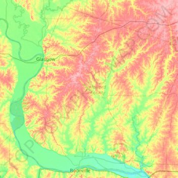
Name: Howard County topographic map, elevation, terrain.
Location: Howard County, Missouri, United States (38.97026 -92.94551 39.34481 -92.43067)
Average elevation: 712 ft
Minimum elevation: 558 ft
Maximum elevation: 906 ft
Missouri trails, hiking, mountain biking, running and outdoor activities
Other topographic maps
Click on a map to view its topography, its elevation and its terrain.
Creve Coeur Lake
United States > Missouri > Saint Louis County > Maryland Heights
Average elevation: 492 ft