
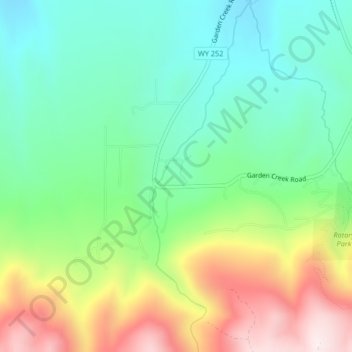
West Fork topographic map
Interactive map
Click on the map to display elevation.
About this map
Name: West Fork topographic map, elevation, terrain.
Location: West Fork, Natrona County, Wyoming, United States (42.75528 -106.35549 42.78562 -106.34402)
Average elevation: 6,368 ft
Minimum elevation: 5,679 ft
Maximum elevation: 7,638 ft
Wyoming trails, hiking, mountain biking, running and outdoor activities
Other topographic maps
Click on a map to view its topography, its elevation and its terrain.
Worland
United States > Wyoming > Washakie County
Due to the location within the Big Horn Basin, it is protected from severe weather by the surrounding mountains from nearly every direction. This topography results in weather that is highly continental with frigid and dry winters, little wind, little rainfall and few storms. Worland is the least windy…
Average elevation: 4,160 ft
South Pass
United States > Wyoming > Fremont County
South Pass (elevation 7,412 ft (2,259 m) and 7,550 ft (2,300 m)) is a route across the Continental Divide, in the Rocky Mountains in southwestern Wyoming. It lies in a broad high region, 35 miles (56 km) wide, between the nearly 14,000 ft (4,300 m) Wind River Range to the north and the over 8,500 ft (2,600 m)…
Average elevation: 7,530 ft
Rocky Mountains
United States > Wyoming > Teton County
Agriculture and forestry are major industries. Agriculture includes dryland and irrigated farming and livestock grazing. Livestock are frequently moved between high-elevation summer pastures and low-elevation winter pastures, a practice known as transhumance.
Average elevation: 7,520 ft
Curt Gowdy State Park
United States > Wyoming > Laramie County
Park terrain consists of rolling hills and sharp granite outcroppings in the foothills of the Laramie Mountains. Elevation ranges from 6,450 feet (1,970 m) to over 7,500 feet (2,290 m). Wildlife that can be found include: kokanee salmon, perch, brown, rainbow and lake trout, white-tailed deer, and mule deer.…
Average elevation: 7,451 ft
Alta
United States > Wyoming > Teton County
Alta is located just east of the Idaho state line, approximately 5 miles (8 km) east of Driggs, at an elevation of 6,440 feet (1,963 m) above sea level.
Average elevation: 8,127 ft
Buck Mountain
United States > Wyoming > Teton County
Buck Mountain (elevation: 11,943 feet (3,640 m)) is a mountain located in the Teton Range, Grand Teton National Park, Wyoming, immediately southeast of Grand Teton.
Average elevation: 10,262 ft
Casper Mountain
United States > Wyoming > Natrona County
Casper Mountain, an anticline, is located at the north end of the Laramie Mountains overlooking Casper, Wyoming along the North Platte River. At a top elevation of 8,130 feet (2,478 m), the geological feature rises approximately 3,000 feet (914 m) above Casper.
Average elevation: 7,595 ft
Rendezvous Mountain
United States > Wyoming > Teton County > Teton Village
Average elevation: 9,281 ft
Evanston
United States > Wyoming > Uinta County > Evanston
Evanston is located at 41°15′48″N 110°57′53″W / 41.26333°N 110.96472°W / 41.26333; -110.96472 (41.263302, −110.964616). The elevation is 6749 feet (2057 m) above sea level.
Average elevation: 7,077 ft
Obsidian Cliff
United States > Wyoming > Park County
The cliff was formed from thick rhyolite lava flow that occurred about 180,000 years ago. The vertical columns are cooling fractures that formed as the thick lava flow cooled and crystallized. The Cliffs stands at an elevation of nearly 7,400 feet (2,300 m) above sea level and goes on for about half a mile.…
Average elevation: 7,746 ft
Mount Washburn
United States > Wyoming > Park County
Mount Washburn, elevation 10,219 feet (3,115 m), is a prominent mountain peak in the Washburn Range in Yellowstone National Park, Wyoming. The peak was named in 1870 to honor Henry D. Washburn, leader of the Washburn–Langford–Doane Expedition. The Washburn Range is one of two mountains ranges completely…
Average elevation: 9,180 ft
Arrowhead Springs
United States > Wyoming > Sweetwater County > Arrowhead Springs
Average elevation: 6,745 ft
Hayden Valley
United States > Wyoming > Park County
A grassy valley, branching between low ridges, running from the river toward the center of the basin. A small stream rose in this valley, breaking through the ridges to the west in a deep cañon, and falling into the channel of the Yellowstone, which here bears in a northeast course, flowing in view as far as…
Average elevation: 7,785 ft
Laramie
United States > Wyoming > Albany County > Laramie
Laramie is on a high plain between two mountain ranges, the Snowy Range, about 30 miles (48 km) to the west, and the Laramie Range, 7 miles (11 km) to the east. The city's elevation above sea level is approximately 7,165 feet (2,184 m). The Laramie River runs through Laramie toward its confluence with the…
Average elevation: 7,543 ft