
Préfecture de Hyōgo topographic map
Interactive map
Click on the map to display elevation.
About this map
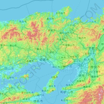
Name: Préfecture de Hyōgo topographic map, elevation, terrain.
Location: Préfecture de Hyōgo, Japon (34.01222 134.25274 35.87451 135.46859)
Average elevation: 650 ft
Minimum elevation: -13 ft
Maximum elevation: 6,070 ft
Other topographic maps
Click on a map to view its topography, its elevation and its terrain.