
亘理郡 topographic map
Interactive map
Click on the map to display elevation.
About this map
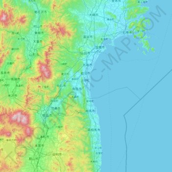
Name: 亘理郡 topographic map, elevation, terrain.
Location: 亘理郡, Préfecture de Miyagi, Japon (37.29335 140.17704 38.69335 141.57704)
Average elevation: 764 ft
Minimum elevation: -10 ft
Maximum elevation: 6,631 ft
Other topographic maps
Click on a map to view its topography, its elevation and its terrain.