
Yamagata topographic map
Interactive map
Click on the map to display elevation.
About this map
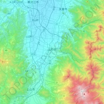
Name: Yamagata topographic map, elevation, terrain.
Location: Yamagata, Préfecture de Yamagata, Japon (38.14350 140.17924 38.35199 140.53068)
Average elevation: 1,503 ft
Minimum elevation: 262 ft
Maximum elevation: 6,024 ft
Other topographic maps
Click on a map to view its topography, its elevation and its terrain.