
鲁甸县 topographic map
Interactive map
Click on the map to display elevation.
About this map
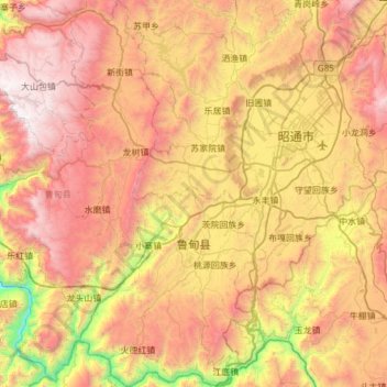
Name: 鲁甸县 topographic map, elevation, terrain.
Location: 鲁甸县, 昭通市, 云南省, 中国 (26.98912 103.15482 27.53073 103.66718)
Average elevation: 7,018 ft
Minimum elevation: 3,091 ft
Maximum elevation: 11,001 ft
鲁甸县是中华人民共和国云南省昭通市下属的一个县。最高海拔为3356米,最低海拔为568米。县城文屏镇海拔1917米。
Other topographic maps
Click on a map to view its topography, its elevation and its terrain.