
巧家县 topographic map
Interactive map
Click on the map to display elevation.
About this map
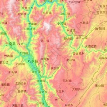
Name: 巧家县 topographic map, elevation, terrain.
Location: 巧家县, 昭通市, 云南省, 中国 (26.53595 102.86946 27.42515 103.44096)
Average elevation: 6,946 ft
Minimum elevation: 1,768 ft
Maximum elevation: 13,173 ft
Other topographic maps
Click on a map to view its topography, its elevation and its terrain.