
以勒镇 topographic map
Interactive map
Click on the map to display elevation.
About this map
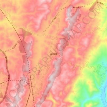
Name: 以勒镇 topographic map, elevation, terrain.
Location: 以勒镇, 昭通市, 云南省, 中国 (27.57910 105.10056 27.65910 105.18056)
Average elevation: 5,092 ft
Minimum elevation: 3,586 ft
Maximum elevation: 5,840 ft
Other topographic maps
Click on a map to view its topography, its elevation and its terrain.