
镇雄县 topographic map
Interactive map
Click on the map to display elevation.
About this map
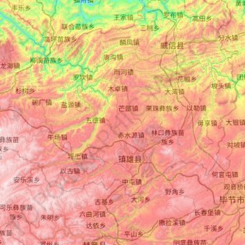
Name: 镇雄县 topographic map, elevation, terrain.
Location: 镇雄县, 昭通市, 云南省, 中国 (27.29403 104.30276 27.83257 105.30639)
Average elevation: 5,075 ft
Minimum elevation: 1,673 ft
Maximum elevation: 8,376 ft
Other topographic maps
Click on a map to view its topography, its elevation and its terrain.