
永善县 topographic map
Interactive map
Click on the map to display elevation.
About this map
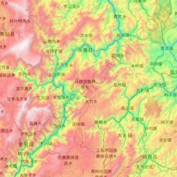
Name: 永善县 topographic map, elevation, terrain.
Location: 永善县, 昭通市, 云南省, 中国 (27.50778 103.26005 28.52018 104.02683)
Average elevation: 5,968 ft
Minimum elevation: 1,158 ft
Maximum elevation: 13,186 ft
Other topographic maps
Click on a map to view its topography, its elevation and its terrain.