
彝良县 topographic map
Interactive map
Click on the map to display elevation.
About this map
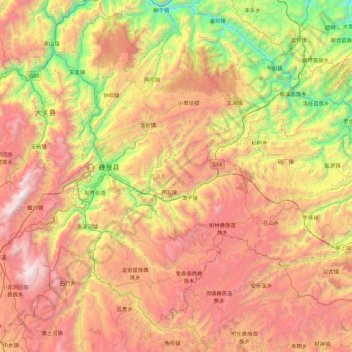
Name: 彝良县 topographic map, elevation, terrain.
Location: 彝良县, 昭通市, 云南省, 中国 (27.26635 103.85216 27.94391 104.75188)
Average elevation: 5,548 ft
Minimum elevation: 1,476 ft
Maximum elevation: 10,331 ft
Other topographic maps
Click on a map to view its topography, its elevation and its terrain.