Geolocate

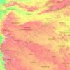
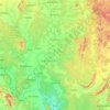
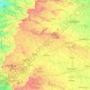
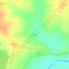
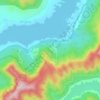
Mulshi Subdistrict topographic map

Click on the map to display elevation.

About this map

Name: Mulshi Subdistrict topographic map, elevation, terrain.

Location: Mulshi Subdistrict, Pune District, Maharashtra, India (18.35147 73.32271 18.67793 73.78538)

Average elevation: 2,156 ft

Minimum elevation: 138 ft

Maximum elevation: 4,298 ft

Other topographic maps

Click on a map to view its topography, its elevation and its terrain.
Pune

India > Maharashtra > Pune City Subdistrict

Average elevation: 2,103 ft

Maharashtra

India > Maharashtra

Maharashtra is the third largest state by area in India. The Western Ghats better known as Sahyadri, are a hilly range running parallel to the coast, at an average elevation of 1,200 metres (4,000 ft). Kalsubai, a peak in the Sahyadris, near Nashik city is the highest elevated point in Maharashtra. To the west…

Average elevation: 1,568 ft
Panvel

India > Maharashtra > Panvel > Panvel

Matheran is a hill station and a municipal council in the Raigad district in the Indian state of Maharashtra. It is a hill station in Karjat Tahsil and is also the smallest hill station in India. It is located on the Western Ghats range at an elevation of around 800 m (2,625 feet) above sea level. It is…

Average elevation: 246 ft
Tillari Dam

India > Maharashtra > Dodamarg Taluka

Average elevation: 295 ft

Pune

India > Maharashtra > Pune City Subdistrict

Average elevation: 2,103 ft

Amravati

India > Maharashtra > Amravati

Amravati is located at 20°56′N 77°45′E / 20.93°N 77.75°E / 20.93; 77.75. It has an average elevation of 343 meters (1125 feet). It lies 156 km (97 mi) west of Nagpur and serves as the administrative centre of Amravati District and of Amravati Division. The city is located near the passes…

Average elevation: 1,132 ft

Shendra MIDC

India > Maharashtra > Shendra MIDC

Average elevation: 1,952 ft

Ghatkopar Hill

India > Maharashtra > Mumbai

Average elevation: 164 ft

Raigad Fort

India > Maharashtra > Mahad > Hirkaniwadi

Average elevation: 1,476 ft

Sindhudurg Fort

India > Maharashtra > Malwan > Malvan

Average elevation: 3 ft

Dombivli

India > Maharashtra > Kalyan Subdistrict > Kalyan-Dombivli

Dombivli is located at 19°13′06″N 73°05′12″E / 19.218433°N 73.086718°E / 19.218433; 73.086718. It has an average elevation of 13.534 meters (44.403 feet). The land here is rough and rocky by nature. The Ulhas river flows from its north.

Average elevation: 36 ft

Malkhed

India > Maharashtra > Haveli

Average elevation: 2,067 ft

Indian subcontinent

India > Maharashtra > Arni

Average elevation: 1,155 ft

Tarapur

India > Maharashtra > Palghar Taluka > Boisar

Average elevation: 52 ft

Mumbai

India > Maharashtra

Mumbai lies at the mouth of the Ulhas River on the western coast of India, in the coastal region known as the Konkan. It sits on Salsette Island (Sashti Island), which it partially shares with the Thane district. Mumbai is bounded by the Arabian Sea to the west. Many parts of the city lie just above sea level,…

Average elevation: 43 ft
Mumbai

India > Maharashtra

Mumbai lies at the mouth of the Ulhas River on the western coast of India, in the coastal region known as the Konkan. It sits on Salsette Island (Sashti Island), which it partially shares with the Thane district. Mumbai is bounded by the Arabian Sea to the west. Many parts of the city lie just above sea level,…

Average elevation: 43 ft

Mandangad

India > Maharashtra > Mandangad Taluka

Average elevation: 702 ft

Mahar Thana

India > Maharashtra > Mulshi Subdistrict

Average elevation: 2,231 ft

Chandrapur

India > Maharashtra

Average elevation: 797 ft

Nashik

India > Maharashtra

Average elevation: 1,821 ft

Jalgaon

India > Maharashtra

Average elevation: 1,181 ft

Mhalunge

India > Maharashtra

Average elevation: 2,559 ft

Ahmadnagar

India > Maharashtra

Average elevation: 1,955 ft

Girna River

India > Maharashtra

Average elevation: 1,207 ft

Koyna River

India > Maharashtra

Average elevation: 1,135 ft

Dharavi

India > Maharashtra

Average elevation: 20 ft

Bhatsa

India > Maharashtra

Average elevation: 427 ft

Yelgaon Dam

India > Maharashtra

Average elevation: 2,005 ft

Kale

India > Maharashtra

Average elevation: 1,929 ft

Degma Bk

India > Maharashtra

Average elevation: 1,263 ft

Asoli

India > Maharashtra

Average elevation: 968 ft

Shivneri Fort

India > Maharashtra > Junnar > Junnar

Average elevation: 2,448 ft

Yeola

India > Maharashtra > Yeola Taluka

Average elevation: 1,834 ft

Tambha

India > Maharashtra > Deoli

Average elevation: 827 ft

Gorai

India > Maharashtra

Average elevation: 16 ft

Devbag

India > Maharashtra > Malvan Taluka

Average elevation: 52 ft

Bhudargad

India > Maharashtra > Gargoti > Thanewadi

Average elevation: 2,759 ft

Parbhani

India > Maharashtra > Parbhani

Parbhani is located at 19°16′N 76°47′E / 19.27°N 76.78°E / 19.27; 76.78. It has an average elevation of 347 metres.

Average elevation: 1,348 ft
Navi Mumbai

India > Maharashtra > Thane > Navi Mumbai

Navi Mumbai (Marathi pronunciation: , also known by its former name New Bombay), is a planned city off the west coast of the Indian state of Maharashtra in Konkan division. The city is divided into two parts, North Navi Mumbai and South Navi Mumbai, for the individual development of Panvel Mega City, which…

Average elevation: 98 ft

Ramtek

India > Maharashtra > Ramtek

Average elevation: 1,056 ft

Kolhapur

India > Maharashtra > Karvir

Kolhapur is an inland city located in south-west Maharashtra state, 373 km (232 mi) south of Mumbai and 228 km (142 mi) south of Pune, 615 km (382 mi) north-west of Bengaluru and 530 km (330 mi) west of Hyderabad. Within Maharashtra, Kolhapur's nearest cities and towns are Ichalkaranji 27 km (17 mi), Kodoli 35…

Average elevation: 1,942 ft

Kashid Beach

India > Maharashtra > Kashid

Average elevation: 121 ft

Ajinkyatara Fort

India > Maharashtra > Satara > Satara

Ajinkyatara Fort, also known as the "Fort of the Sapta-Rishi," is a historical hill fort located on Ajinkyatara Mountain, one of the seven mountains surrounding the city of Satara in the Sahyadri Mountains of Maharashtra, India. Situated at an altitude of 3,300 feet, the fort overlooks Satara City and is…

Average elevation: 2,507 ft
Vetal Tekdi

India > Maharashtra > Pune City

Average elevation: 2,041 ft

Temghar dam

India > Maharashtra > Mulshi Subdistrict

Average elevation: 2,444 ft

Tathawade

India > Maharashtra > Mulshi Subdistrict

Average elevation: 1,893 ft

Prakasha

India > Maharashtra > Shahada Taluka

Average elevation: 384 ft

Shinoli

India > Maharashtra > Ambegaon

Average elevation: 2,254 ft

Butibori

India > Maharashtra > Nagpur Rural Taluka

Average elevation: 889 ft

Kalandri

India > Maharashtra > Umred

Average elevation: 974 ft

Dharashiv

India > Maharashtra > Dharashiv

The city of Osmanabad has an elevation of 653 metres (2,142 ft). Osmanabad is located in the west-central part of Osmanabad Tahsil. Nearby towns include Tuljapur, Bhoom, Paranda, Washi, and Kalamb. Solapur, located southwest of Osmanabad in Solapur district, is the nearest sizeable city. Osmanabad is on the…

Average elevation: 2,031 ft
Bhamragarh WLS

India > Maharashtra > Bhamragad Taluka > Gundurwahi

Average elevation: 1,493 ft

Tamhini

India > Maharashtra > Mulshi

Average elevation: 2,398 ft

Lavasa

India > Maharashtra > Mulshi Subdistrict

Average elevation: 2,677 ft

Maan

India > Maharashtra > Mulshi Subdistrict

Average elevation: 1,939 ft

Katrabai

India > Maharashtra > Akola

Average elevation: 3,409 ft

Mama Bhanja

India > Maharashtra > Thane Subdistrict > Thane

Average elevation: 581 ft

Pabargad

India > Maharashtra > Akola > Mutkhel

Average elevation: 3,133 ft

Mama Bhanja

India > Maharashtra > Thane Subdistrict > Thane

Average elevation: 581 ft

Chowk

India > Maharashtra > Khalapur Taluka

Average elevation: 174 ft

Miraj

India > Maharashtra > Miraj

Average elevation: 1,821 ft

Nandgao Tanda

India > Maharashtra > Ambejogai

Average elevation: 2,126 ft

Bhawan

India > Maharashtra > Sillod

Average elevation: 1,955 ft

Ane

India > Maharashtra > Junnar

Average elevation: 2,703 ft

Moula Ali

India > Maharashtra > Mukhed > Manjari

Average elevation: 1,486 ft

Malegaon Budruk

India > Maharashtra > Georai

Average elevation: 1,470 ft

Selgaon (umate)

India > Maharashtra > Karanja

Average elevation: 1,588 ft

Rajapur

India > Maharashtra > Rajapur Taluka

Average elevation: 440 ft

Dhalewadi

India > Maharashtra > Patoda

Average elevation: 2,441 ft

Sasura

India > Maharashtra > Kaij

Average elevation: 2,392 ft

Shirgaon

India > Maharashtra > Tasgaon

Average elevation: 1,949 ft

Alibag

India > Maharashtra > Alibag Taluka

Alibag is located about 120 km south of Mumbai, at 18°38′29″N 72°52′20″E / 18.64139°N 72.87222°E / 18.64139; 72.87222. The average elevation is 0 metres (0 feet).The District Government offices are located along the sea coast road. Alibag is the center place of Raigad District.

Average elevation: 39 ft
Solapur

India > Maharashtra > Solapur North

Solapur is located at 17°41′N 75°55′E / 17.68°N 75.92°E / 17.68; 75.92. It has an average elevation of 458 metres (1502 feet). It is bordered by Ahmednagar district on the north; Osmanabad district on the north and northeast.

Average elevation: 1,539 ft
Mahad

India > Maharashtra > Mahad Taluka

Several disasters like floods and landslides have continuously devastated markets and old houses, specifically classic Konkani-styled architecture, causing great loss of life. This is primarily due to lower elevation of the city compared to surrounding areas and being surrounded by rivers on all sides, making…

Average elevation: 246 ft

Pandharpur

India > Maharashtra > Pandharpur

Average elevation: 1,506 ft

Saswad

India > Maharashtra > Purandhar

Average elevation: 2,582 ft

Rasayani

India > Maharashtra > Khalapur Taluka

Average elevation: 157 ft

Patnus

India > Maharashtra > Mangaon

Average elevation: 433 ft

korlai

India > Maharashtra > Murud Taluka > Korlai

Average elevation: 7 ft

Waifad

India > Maharashtra > Wardha

Average elevation: 922 ft

Ghatghar

India > Maharashtra > Junnar

Average elevation: 2,484 ft

Bhimashankar

India > Maharashtra > Khed

Average elevation: 2,457 ft

Ganeshgaon

India > Maharashtra > Malshiras

Average elevation: 1,585 ft

Naigaon Mayur WLS

India > Maharashtra > Patoda > Naigaon

Average elevation: 2,231 ft

Naigaon

India > Maharashtra > Patoda

Average elevation: 2,172 ft

Naigaon

India > Maharashtra > Kaij

Average elevation: 2,100 ft

Patoda Belkhandi

India > Maharashtra > Beed

Average elevation: 2,224 ft

Kudali

India > Maharashtra > Roha

Average elevation: 407 ft

Achra

India > Maharashtra > Malvan Taluka

Average elevation: 72 ft

Ujani

India > Maharashtra > Ausa

Average elevation: 2,021 ft

Yelavi

India > Maharashtra > Jat

Average elevation: 1,913 ft

Joggers Park

India > Maharashtra > Mumbai

Average elevation: 20 ft

Moshi Traffic Park

India > Maharashtra > Haveli > Pimpri-Chinchwad

Average elevation: 1,978 ft

Mulshi

India > Maharashtra > Mulshi

Average elevation: 2,441 ft

Wadgaon J.

India > Maharashtra > Kalamb

Average elevation: 2,211 ft

Lonavala

India > Maharashtra > Mawal

Adjacent to the Lohagad fort lies the visapur fort which is part of the Lohagad-Visapur fortification. Visapur Fort is larger and at a higher elevation than its twin- Lohagad. It was built during 1713-1720 CE by Balaji Vishwanath.

Average elevation: 2,011 ft

Gear up for your next adventure:

❄️Traction Cleats - Prevent slips on icy trails during winter hikes
🧤Tactile Hiking Gloves - Keep hands warm while operating GPS and smartphone screens
🎁Geography Themed Gifts - Unique gift ideas for map lovers and geography enthusiasts
📚USA Hiking Guide Books - Top trail guides and map books
🥩Freeze-Dried Meals - Nutritious and lightweight food for remote expeditions

As an Amazon Associate, this site earns from qualifying purchases at no extra cost to you.