
Make a donation
Gear up for your next adventure:
As an Amazon Associate, this site earns from qualifying purchases at no extra cost to you.
Humboldt County topographic map
Click on the map to display elevation.
Make a donation
Gear up for your next adventure:
As an Amazon Associate, this site earns from qualifying purchases at no extra cost to you.
About this map
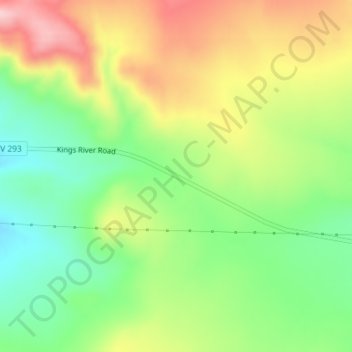
Name: Humboldt County topographic map, elevation, terrain.
Location: Humboldt County, Nevada, United States, Thacker Pass (41.70185 -118.07717 41.70195 -118.07707)
Average elevation: 4,990 ft
Minimum elevation: 4,688 ft
Maximum elevation: 5,367 ft
Nevada trails, hiking, mountain biking, running and outdoor activities
Make a donation
Gear up for your next adventure:
As an Amazon Associate, this site earns from qualifying purchases at no extra cost to you.
Other topographic maps
Click on a map to view its topography, its elevation and its terrain.
Valley of Fire State Park
Valley of Fire is located 50 miles (80 km) northeast of Las Vegas, at an elevation between 1,320–3,009 feet (402–917 m). It abuts the Lake Mead National Recreation Area on the east at the Virgin River confluence. It lies in a 4 by 6 mi (6.4 by 9.7 km) basin.
Average elevation: 2,014 ft
Lake Mead
United States > Nevada > Clark County
At maximum capacity, Lake Mead is 112 miles (180 km) long, 532 feet (162 m) at its greatest depth, has a surface elevation of 1,221.4 feet (372.3 m) above sea level and 247 square miles (640 km2) of surface area, and contains 26.12 million acre feet (3.222×10¹³ L) of water.
Average elevation: 2,244 ft
Make a donation
Gear up for your next adventure:
As an Amazon Associate, this site earns from qualifying purchases at no extra cost to you.
Make a donation
Gear up for your next adventure:
As an Amazon Associate, this site earns from qualifying purchases at no extra cost to you.
Yerington
United States > Nevada > Lyon County
During the summer, temperatures are generally hot to very hot in the afternoon, but the high altitude and low humidity means temperature drop to a comfortable level at night. On average, 8.0 afternoons each summer will exceed 100 °F or 37.8 °C and 73.2 afternoons reach 90 °F (32.2 °C). It is rare, though,…
Average elevation: 4,455 ft
Dixie Valley - Fairview Peak 7.1 Earthquake 1954 Fault Line
United States > Nevada > Churchill County
Average elevation: 5,961 ft
Make a donation
Gear up for your next adventure:
As an Amazon Associate, this site earns from qualifying purchases at no extra cost to you.
Pine Forest Range Wilderness Area
United States > Nevada > Humboldt County
Average elevation: 6,834 ft
Angel Lake
United States > Nevada > Elko County
Angel Lake is a glacial tarn in the northern part of the East Humboldt Range, in central Elko County in the northeastern part of the state of Nevada. It is located at approximately 41°01.6′N 115°05.1′W / 41.0267°N 115.0850°W / 41.0267; -115.0850, and at an elevation of 8378 feet (2553 m). It…
Average elevation: 8,766 ft
Make a donation
Gear up for your next adventure:
As an Amazon Associate, this site earns from qualifying purchases at no extra cost to you.
Sand Harbor
United States > Nevada > Washoe County > Incline Village-Crystal Bay
Average elevation: 6,581 ft
Make a donation
Gear up for your next adventure:
As an Amazon Associate, this site earns from qualifying purchases at no extra cost to you.
Make a donation
Gear up for your next adventure:
As an Amazon Associate, this site earns from qualifying purchases at no extra cost to you.
Make a donation
Gear up for your next adventure:
As an Amazon Associate, this site earns from qualifying purchases at no extra cost to you.
Make a donation
Gear up for your next adventure:
As an Amazon Associate, this site earns from qualifying purchases at no extra cost to you.
Make a donation
Gear up for your next adventure:
As an Amazon Associate, this site earns from qualifying purchases at no extra cost to you.
Carey–Lake Mead Detention Basin
United States > Nevada > Clark County > North Las Vegas
Average elevation: 2,126 ft
Make a donation
Gear up for your next adventure:
As an Amazon Associate, this site earns from qualifying purchases at no extra cost to you.
Make a donation
Gear up for your next adventure:
As an Amazon Associate, this site earns from qualifying purchases at no extra cost to you.
Make a donation
Gear up for your next adventure:
As an Amazon Associate, this site earns from qualifying purchases at no extra cost to you.