
保和街道 topographic map
Interactive map
Click on the map to display elevation.
About this map
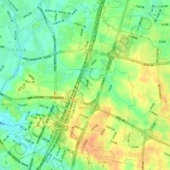
Name: 保和街道 topographic map, elevation, terrain.
Location: 保和街道, 成华区, 成都市, 四川省, 中国 (30.61914 104.11923 30.66619 104.16284)
Average elevation: 1,660 ft
Minimum elevation: 1,601 ft
Maximum elevation: 1,722 ft
Other topographic maps
Click on a map to view its topography, its elevation and its terrain.