
凤凰山街道 topographic map
Interactive map
Click on the map to display elevation.
About this map
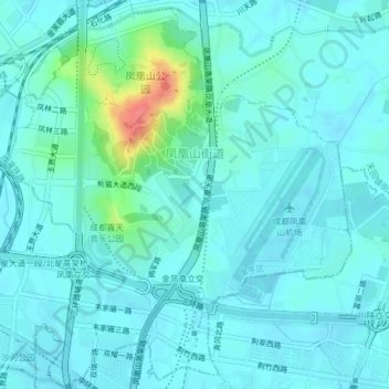
Name: 凤凰山街道 topographic map, elevation, terrain.
Location: 凤凰山街道, 金牛区, 成都市, 四川省, 中国 (30.71522 104.06560 30.74923 104.10039)
Average elevation: 1,683 ft
Minimum elevation: 1,647 ft
Maximum elevation: 1,873 ft
Other topographic maps
Click on a map to view its topography, its elevation and its terrain.