
Clinton County topographic map
Interactive map
Click on the map to display elevation.
About this map
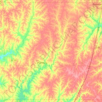
Name: Clinton County topographic map, elevation, terrain.
Location: Clinton County, Missouri, United States (39.45457 -94.60256 39.74780 -94.20583)
Average elevation: 991 ft
Minimum elevation: 830 ft
Maximum elevation: 1,102 ft
Missouri trails, hiking, mountain biking, running and outdoor activities
Other topographic maps
Click on a map to view its topography, its elevation and its terrain.
Creve Coeur Lake
United States > Missouri > Saint Louis County > Maryland Heights
Average elevation: 492 ft