
Titirangi topographic map
Interactive map
Click on the map to display elevation.
About this map
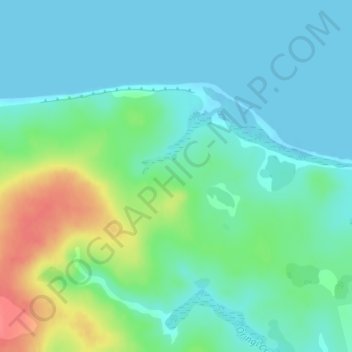
Name: Titirangi topographic map, elevation, terrain.
Location: Titirangi, Chatham Islands, New Zealand (-43.81415 -176.51064 -43.79415 -176.49064)
Average elevation: 56 ft
Minimum elevation: -3 ft
Maximum elevation: 203 ft
Other topographic maps
Click on a map to view its topography, its elevation and its terrain.
Lake Pūkaki
New Zealand > Canterbury > Mackenzie District
The glacial feed to the lakes gives them a distinctive blue colour, created by glacial flour, the extremely finely ground rock particles from the glaciers. Lake Pukaki covers an area of 178.7 km2 (69.0 sq mi), and the surface elevation of the lake normally ranges from 518.2 to 532 metres (1,700 to 1,745 ft)…
Average elevation: 2,907 ft
Lake Wakatipu
New Zealand > Otago > Queenstown-Lakes District
With a length of 80 kilometres (50 mi), it is New Zealand's longest lake, and, at 289 km2 (112 sq mi), its third largest. The lake is also very deep, its floor being below sea level (−110 metres), with a maximum depth of 420 metres (1,380 ft). It is at an altitude of 310 metres (1,020 ft), towards the…
Average elevation: 3,123 ft
Franz Josef Glacier
New Zealand > West Coast > Westland District
The névé or snowfield at the head of Franz Josef Glacier is over 2,500 metres (8,200 ft) above sea level and 20 square kilometres (7.7 sq mi) in area. This wide névé, which is over 300 metres (980 ft) deep, feeds large amounts of compacted snow into a steep and narrow valley which drops quickly to very low…
Average elevation: 5,607 ft
Kahurangi National Park
The special character of flora and fauna in the region was recognised prior to 1920. One particular example is the Gouland Downs, an area with unusual geology and vegetation, situated at around 600 m (2,000 ft) elevation to the west of Mt Perry. The Gouland Downs was one of eleven sanctuaries designated by the…
Average elevation: 1,109 ft
Taipa River
New Zealand > Northland > Far North District > Te Hiku Community > Cable Bay
Average elevation: 82 ft
Whitewater River
New Zealand > Southland > Southland District > Fiordland Community
Average elevation: 1,808 ft
Shalamar Reserve
New Zealand > Canterbury > Christchurch City > Christchurch
Average elevation: 157 ft
Stewart Island
Although the clay soil is not very fertile, the high rainfall and warm weather mean that the island is densely forested throughout. Native plants include the world's southernmost dense forest of podocarps (southern conifers) and hardwoods such as rātā and kāmahi in the lowland areas with mānuka shrubland…
Average elevation: 207 ft
Milford Sound
New Zealand > Southland > Southland District > Fiordland Community
Average elevation: 2,149 ft
Halswell-Hornby-Riccarton Community
New Zealand > Canterbury > Christchurch City
Average elevation: 161 ft
Kaikōura
The Hutton's shearwater (Puffinus huttoni) or Kaikōura tītī is an endangered seabird in the family Procellariidae. It is found in waters around Australia and New Zealand but it only breeds in the Seaward Kaikōura Range in New Zealand. It is the only seabird in the world that breeds in an alpine…
Average elevation: 1,739 ft
Misty River
New Zealand > Southland > Southland District > Fiordland Community
Average elevation: 1,240 ft
Linwood-Central-Heathcote Community
New Zealand > Canterbury > Christchurch City > Linwood-Central-Heathcote Community
Average elevation: 180 ft