
Morgan County topographic map
Interactive map
Click on the map to display elevation.
About this map
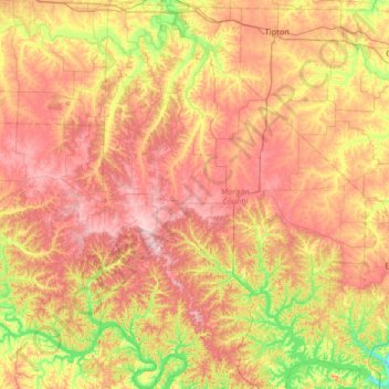
Name: Morgan County topographic map, elevation, terrain.
Location: Morgan County, Missouri, United States (38.18629 -93.07773 38.69752 -92.62415)
Average elevation: 876 ft
Minimum elevation: 558 ft
Maximum elevation: 1,181 ft
Missouri trails, hiking, mountain biking, running and outdoor activities
Other topographic maps
Click on a map to view its topography, its elevation and its terrain.
Creve Coeur Lake
United States > Missouri > Saint Louis County > Maryland Heights
Average elevation: 492 ft