
Saline County topographic map
Interactive map
Click on the map to display elevation.
About this map
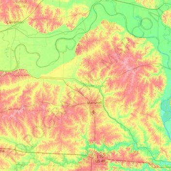
Name: Saline County topographic map, elevation, terrain.
Location: Saline County, Missouri, United States (38.93234 -93.49641 39.41175 -92.85239)
Average elevation: 715 ft
Minimum elevation: 581 ft
Maximum elevation: 879 ft
Missouri trails, hiking, mountain biking, running and outdoor activities
Other topographic maps
Click on a map to view its topography, its elevation and its terrain.
Creve Coeur Lake
United States > Missouri > Saint Louis County > Maryland Heights
Average elevation: 492 ft