
Adair County topographic map
Interactive map
Click on the map to display elevation.
About this map
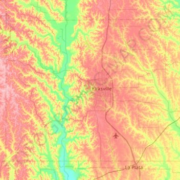
Name: Adair County topographic map, elevation, terrain.
Location: Adair County, Missouri, United States (40.03709 -92.85631 40.34649 -92.34531)
Average elevation: 899 ft
Minimum elevation: 722 ft
Maximum elevation: 1,056 ft
Missouri trails, hiking, mountain biking, running and outdoor activities
Other topographic maps
Click on a map to view its topography, its elevation and its terrain.
Creve Coeur Lake
United States > Missouri > Saint Louis County > Maryland Heights
Average elevation: 492 ft