
Monroe County topographic map
Interactive map
Click on the map to display elevation.
About this map
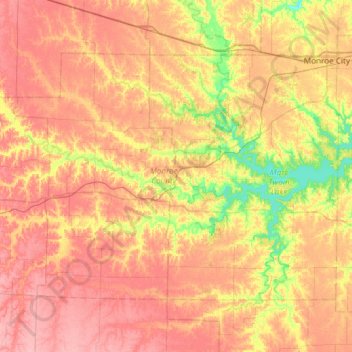
Name: Monroe County topographic map, elevation, terrain.
Location: Monroe County, Missouri, United States (39.33986 -92.31040 39.66343 -91.71393)
Average elevation: 741 ft
Minimum elevation: 584 ft
Maximum elevation: 863 ft
Missouri trails, hiking, mountain biking, running and outdoor activities
Other topographic maps
Click on a map to view its topography, its elevation and its terrain.
Creve Coeur Lake
United States > Missouri > Saint Louis County > Maryland Heights
Average elevation: 492 ft