
Lafayette County topographic map
Interactive map
Click on the map to display elevation.
About this map
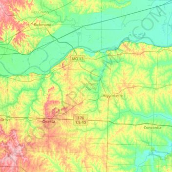
Name: Lafayette County topographic map, elevation, terrain.
Location: Lafayette County, Missouri, United States (38.90912 -94.11472 39.29280 -93.47721)
Average elevation: 784 ft
Minimum elevation: 653 ft
Maximum elevation: 1,086 ft
Missouri trails, hiking, mountain biking, running and outdoor activities
Other topographic maps
Click on a map to view its topography, its elevation and its terrain.
Creve Coeur Lake
United States > Missouri > Saint Louis County > Maryland Heights
Average elevation: 492 ft