
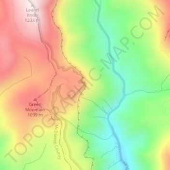
Wiseman's View topographic map
Interactive map
Click on the map to display elevation.
About this map
Name: Wiseman's View topographic map, elevation, terrain.
Average elevation: 2,913 ft
Minimum elevation: 1,877 ft
Maximum elevation: 4,032 ft
North Carolina trails, hiking, mountain biking, running and outdoor activities
Other topographic maps
Click on a map to view its topography, its elevation and its terrain.
Beech Mountain
United States > North Carolina > Watauga County
Beech Mountain is a town in both Avery and Watauga counties in the U.S. state of North Carolina. As of the 2010 census, the town population was 320. The town is located atop Beech Mountain and is the highest town east of the Rocky Mountains at 5,506 ft (1,678 m) in elevation. The nearest municipality at a…
Average elevation: 4,157 ft
Lake Norman
United States > North Carolina > Iredell County > Mooresville
Lake Norman and the surrounding shoreline serve as a habitat for a diverse array of plants and wildlife, as well as a place for a myriad of human activities. Maintaining this habitat to simultaneously preserve endangered species, keep invasive species at bay, and maintain health and safety standards for the…
Average elevation: 833 ft
Pisgah National Forest
United States > North Carolina > Buncombe County
The Pisgah National Forest covers 512,758 acres (801 sq mi; 2,075 km2) of mountainous terrain in the southern Appalachian Mountains, including parts of the Blue Ridge Mountains and Great Balsam Mountains. Elevations reach over 6,000 feet (1,800 m) and include some of the highest mountains in the eastern United…
Average elevation: 2,467 ft
Blue Ridge Parkway
United States > North Carolina > Watauga County
The parkway has been the most visited unit of the National Park System every year since 1946 except four (1949, 2013, 2016 and 2019). Land on either side of the road is owned and maintained by the National Park Service, and in many places parkway land is bordered by United States Forest Service property. There…
Average elevation: 1,654 ft
Nantahala National Forest
United States > North Carolina > Macon County
The terrain varies in elevation from 5,800 feet (1,767.8 m) at Lone Bald in Jackson County, to 1,200 feet (365.8 m) in Cherokee County along the Hiwassee River below the Appalachia Dam. It is the home of many western NC waterfalls. The last part of the Mountain Waters Scenic Byway travels through this forest.…
Average elevation: 2,562 ft
Lake James
United States > North Carolina > Burke County
Lake James is a large reservoir in the mountains of Western North Carolina which straddles the border between Burke and McDowell Counties. It is named for tobacco tycoon and benefactor of Duke University James Buchanan Duke. The lake, with surface elevation of 1200 ft (366 m), lies behind a series of 4 earthen…
Average elevation: 1,250 ft
Carolina North Forest
United States > North Carolina > Orange County > Chapel Hill
Average elevation: 489 ft
Pasquotank County
United States > North Carolina
Almost all of the terrain in Pasquotank County is flatland with a topography near sea level, a characteristic of most of North Carolina's Coastal Plain. The county is flanked by two rivers: the Pasquotank and the Little River.
Average elevation: 10 ft
North Toe River
United States > North Carolina > Mitchell County > Spruce Pine
Average elevation: 2,703 ft
Idlewild Farms
United States > North Carolina > Mecklenburg County > Charlotte
Average elevation: 728 ft
Jordan Lake
United States > North Carolina > Chatham County
The Jordan Lake Dam (also known as the B. Everett Jordan Project and the New Hope Dam) is located at 35°39′15″N 79°4′0″W / 35.65417°N 79.06667°W / 35.65417; -79.06667 (B. Everett Jordan Dam) 4 miles (6.4 km) upstream from the mouth of the Haw River in the upper Cape Fear River drainage…
Average elevation: 335 ft
Kanuga Lake
United States > North Carolina > Henderson County > Kanuga Ridge
Average elevation: 2,356 ft
Echo Lake
United States > North Carolina > Henderson County > Laurel Park > Country Ridge
Average elevation: 2,493 ft
Grandfather Mountain State Park
United States > North Carolina > Watauga County > Banner Elk
Grandfather Mountain rises 5,964 feet (1,818 m) above sea level, and due to the considerable elevation gain the mountain boasts 16 distinct ecological communities. The mountain is famous for its rugged character, and is home to many hidden caves and significant cliffs.
Average elevation: 4,242 ft
Knightdale
United States > North Carolina > Wake County
Knightdale is located in the northeast central region of North Carolina, where the North American Piedmont and Atlantic Coastal Plain regions meet. This area is known as the "Fall Line" because it marks the elevation inland at which waterfalls begin to appear in creeks and rivers. Its central Piedmont location…
Average elevation: 276 ft
Kitty Hawk
United States > North Carolina > Dare County
Kitty Hawk is located at 36°06′N 75°42′W / 36.1°N 75.7°W / 36.1; -75.7 at an elevation of 7 feet (2 m) above sea level.
Average elevation: 7 ft
Lake Johnson
United States > North Carolina > Wake County > Raleigh > Orchards
Average elevation: 397 ft
North Carolina Coastal Land Trust: Orton Plantation Holdings, LLC
United States > North Carolina > Brunswick County
Average elevation: 26 ft
Royal Pines
United States > North Carolina > Buncombe County > Royal Pines
Royal Pines is bordered to the west by U.S. Route 25A and the city limits of Asheville, and to the northeast by Mills Gap Road. Brown Mountain, with an elevation of 2,996 feet (913 m), occupies the center of the CDP.
Average elevation: 2,343 ft
Falls Lake
United States > North Carolina > Durham County
Work on the dam that holds the lake began in 1978 and was completed in 1981. Prior to its construction flooding of the Neuse River caused extensive damage to public and private properties including roadways, railroads, industrial sites and farmlands. The U.S. Army Corps of Engineers constructed and manages the…
Average elevation: 331 ft
Shearon Harris Auxiliary Reservoir Dam
United States > North Carolina > Wake County
Average elevation: 259 ft
Princeville
United States > North Carolina > Edgecombe County
The town also suffered continuing difficulties due to its low elevation and adjacency to the Tar River. Princeville experienced severe flooding in September 1999 when Cape Verde-type Hurricane Floyd pulled coffins from the cemetery and raised water levels to just below the height of rooftops and church…
Average elevation: 46 ft
High Rock Lake
United States > North Carolina > Davidson County
At the time of construction, High Rock was the largest reservoir in North Carolina and one of the largest in the United States. When full, its surface covers 15,180 acres (61 km2) with 360 miles (579 km) of shoreline and is 59 feet (18 m) deep at the dam. Normal pool elevation is 624 feet above sea level…
Average elevation: 692 ft
South Mountains State Park
United States > North Carolina > Burke County
While most of the high points average approximately 2000 feet (609 m) in elevation, Buzzard's Roost towers some 3000 feet (914 m) above the surrounding landscape. Elevations within the park itself range from less than 1200 feet (365 m) at points along Jacob's Fork River to 3,000 feet (914 m) on Buzzard's Roost…
Average elevation: 1,634 ft