
迎泽区 topographic map
Interactive map
Click on the map to display elevation.
About this map
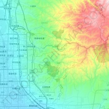
Name: 迎泽区 topographic map, elevation, terrain.
Location: 迎泽区, 太原市, 山西省, 中国 (37.80706 112.53011 37.92190 112.77120)
Average elevation: 3,379 ft
Minimum elevation: 2,536 ft
Maximum elevation: 5,702 ft
Other topographic maps
Click on a map to view its topography, its elevation and its terrain.