
古交市 topographic map
Interactive map
Click on the map to display elevation.
About this map
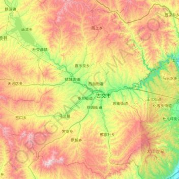
Name: 古交市 topographic map, elevation, terrain.
Location: 古交市, 太原市, 山西省, 中国 (37.66898 111.72731 38.17549 112.33687)
Average elevation: 4,524 ft
Minimum elevation: 2,533 ft
Maximum elevation: 7,182 ft
Other topographic maps
Click on a map to view its topography, its elevation and its terrain.