
娄烦县 topographic map
Interactive map
Click on the map to display elevation.
About this map
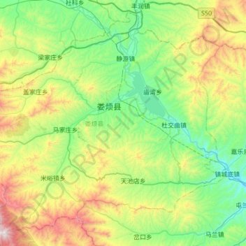
Name: 娄烦县 topographic map, elevation, terrain.
Location: 娄烦县, 太原市, 山西省, 中国 (37.84728 111.50892 38.22953 112.04702)
Average elevation: 4,787 ft
Minimum elevation: 3,291 ft
Maximum elevation: 8,717 ft
娄烦县境四周高山环绕,与邻近各县构成天然分界,属吕梁山系、最高山峰北云顶(海拔2659米),地势由西南向东南倾斜。其余部分由黄土丘陵地和河谷平川地。经流的河流主要有汾河及其支流涧河等。境内主要水库有汾河水库。
Other topographic maps
Click on a map to view its topography, its elevation and its terrain.