
阳曲县 topographic map
Interactive map
Click on the map to display elevation.
About this map
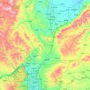
Name: 阳曲县 topographic map, elevation, terrain.
Location: 阳曲县, 太原市, 山西省, 中国 (37.93588 112.19950 38.42085 113.14779)
Average elevation: 3,927 ft
Minimum elevation: 2,438 ft
Maximum elevation: 7,300 ft
Other topographic maps
Click on a map to view its topography, its elevation and its terrain.