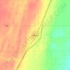
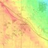
Lipton topographic map
Click on the map to display elevation.
About this map

Name: Lipton topographic map, elevation, terrain.
Location: Lipton, Saskatchewan, Canada (50.89911 -103.85435 50.90640 -103.84265)
Average elevation: 1,988 ft
Minimum elevation: 1,955 ft
Maximum elevation: 2,024 ft
Other topographic maps
Click on a map to view its topography, its elevation and its terrain.













Paradise Hill
Canada > Saskatchewan > Division No. 17 > Frenchman Butte No. 501
Average elevation: 2,123 ft


Porcupine Hills
Canada > Saskatchewan > Hudson Bay No. 394
The Porcupine Hills refer to various groups of hills and uplands in the Canadian provinces of Saskatchewan and Manitoba. They are part of the Manitoba Escarpment, which was the shoreline of the ancient glacial Lake Agassiz. The hills are located north-west of Swan River, Manitoba, and are the headwaters of the…
Average elevation: 2,005 ft

Buffalo Pound Provincial Park
Canada > Saskatchewan > Marquis No. 191
Nicolle Flats Marsh, with a total area of 73.18 km2 (28.25 sq mi) and an elevation of 511 m (1,677 ft), is a large marshy area located in the park at the south-east corner of Buffalo Pound Lake. The confluence of the Qu'Appelle and Moose Jaw Rivers is in the marsh. The area is an Important Bird Area of Canada…
Average elevation: 1,877 ft


McClean Lake
Canada > Saskatchewan > Division No. 18 > Unorganized Division No. 18
Average elevation: 1,444 ft
Grasslands National Park of Canada
Canada > Saskatchewan > Waverley No. 44
Average elevation: 2,694 ft



Onion Lake
Canada > Saskatchewan > Division No. 17 > Frenchman Butte No. 501
Average elevation: 2,024 ft