
Avonlea topographic map
Click on the map to display elevation.
About this map
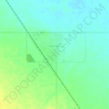
Name: Avonlea topographic map, elevation, terrain.
Location: Avonlea, Saskatchewan, S0H 0C0, Canada (50.00705 -105.06644 50.01789 -105.04369)
Average elevation: 1,969 ft
Minimum elevation: 1,942 ft
Maximum elevation: 2,008 ft
Other topographic maps
Click on a map to view its topography, its elevation and its terrain.
McClean Lake
Canada > Saskatchewan > Division No. 18 > Unorganized Division No. 18
Average elevation: 1,444 ft
Grasslands National Park of Canada
Canada > Saskatchewan > Waverley No. 44
Average elevation: 2,694 ft
Onion Lake
Canada > Saskatchewan > Division No. 17 > Frenchman Butte No. 501
Average elevation: 2,024 ft
La Loche
Canada > Saskatchewan > Northern Saskatchewan Administration District > La Loche
Average elevation: 1,467 ft
Pelican Narrows
Canada > Saskatchewan > Northern Saskatchewan Administration District > Pelican Narrows
Average elevation: 1,053 ft