
屯留区 topographic map
Interactive map
Click on the map to display elevation.
About this map
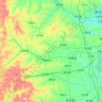
Name: 屯留区 topographic map, elevation, terrain.
Location: 屯留区, 长治市, 山西省, 中国 (36.18860 112.44277 36.50884 113.04206)
Average elevation: 3,445 ft
Minimum elevation: 2,792 ft
Maximum elevation: 5,377 ft
Other topographic maps
Click on a map to view its topography, its elevation and its terrain.