
Thank you for supporting this site ❤️
Make a donation
Make a donation
Gear up for your next adventure:
As an Amazon Associate, this site earns from qualifying purchases at no extra cost to you.
Julcán topographic map
Click on the map to display elevation.
Thank you for supporting this site ❤️
Make a donation
Make a donation
Gear up for your next adventure:
As an Amazon Associate, this site earns from qualifying purchases at no extra cost to you.
About this map
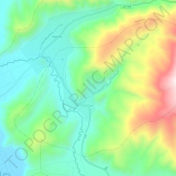
Name: Julcán topographic map, elevation, terrain.
Location: Julcán, Provincia de Jauja, Junín, Perú (-11.77585 -75.45959 -11.73208 -75.40219)
Average elevation: 11,841 ft
Minimum elevation: 11,001 ft
Maximum elevation: 13,533 ft
Thank you for supporting this site ❤️
Make a donation
Make a donation
Gear up for your next adventure:
As an Amazon Associate, this site earns from qualifying purchases at no extra cost to you.