
Midale topographic map
Click on the map to display elevation.
About this map
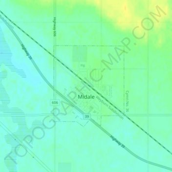
Name: Midale topographic map, elevation, terrain.
Location: Midale, Saskatchewan, S0C 1S0, Canada (49.38998 -103.41921 49.40273 -103.40229)
Average elevation: 1,909 ft
Minimum elevation: 1,883 ft
Maximum elevation: 1,955 ft
Other topographic maps
Click on a map to view its topography, its elevation and its terrain.
Clearwater River
Canada > Saskatchewan > Division No. 18 > Unorganized Division No. 18
From Broach Lake at an elevation of 460 metres (1,510 ft) above sea level, the Clearwater drops about 150 metres (490 ft) to the confluence at Fort McMurray. Its waters eventually reach the Arctic Ocean via the Athabasca and Mackenzie Rivers. Tributaries of the Clearwater River include Descharme River and…
Average elevation: 1,476 ft
McClean Lake
Canada > Saskatchewan > Division No. 18 > Unorganized Division No. 18
Average elevation: 1,444 ft
Grasslands National Park of Canada
Canada > Saskatchewan > Waverley No. 44
Average elevation: 2,694 ft
Onion Lake
Canada > Saskatchewan > Division No. 17 > Frenchman Butte No. 501
Average elevation: 2,024 ft
La Loche
Canada > Saskatchewan > Northern Saskatchewan Administration District > La Loche
Average elevation: 1,467 ft
Pelican Narrows
Canada > Saskatchewan > Northern Saskatchewan Administration District > Pelican Narrows
Average elevation: 1,053 ft