
吕梁市 topographic map
Interactive map
Click on the map to display elevation.
About this map
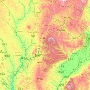
Name: 吕梁市 topographic map, elevation, terrain.
Location: 吕梁市, 山西省, 033000, 中国 (36.73595 110.37094 38.73027 112.31573)
Average elevation: 3,973 ft
Minimum elevation: 1,726 ft
Maximum elevation: 9,032 ft
Other topographic maps
Click on a map to view its topography, its elevation and its terrain.