
长治市 topographic map
Interactive map
Click on the map to display elevation.
About this map
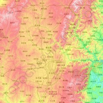
Name: 长治市 topographic map, elevation, terrain.
Location: 长治市, 山西省, 中国 (35.82276 111.97506 37.12483 113.73457)
Average elevation: 3,465 ft
Minimum elevation: 781 ft
Maximum elevation: 6,860 ft
Other topographic maps
Click on a map to view its topography, its elevation and its terrain.