
兴县 topographic map
Interactive map
Click on the map to display elevation.
About this map
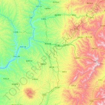
Name: 兴县 topographic map, elevation, terrain.
Location: 兴县, 吕梁市, 山西省, 中国 (38.09432 110.54767 38.73027 111.47642)
Average elevation: 4,088 ft
Minimum elevation: 2,385 ft
Maximum elevation: 7,362 ft
Other topographic maps
Click on a map to view its topography, its elevation and its terrain.