
镇远县 topographic map
Interactive map
Click on the map to display elevation.
About this map
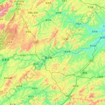
Name: 镇远县 topographic map, elevation, terrain.
Location: 镇远县, 黔东南苗族侗族自治州, 贵州省, 中国 (26.79481 108.14637 27.37041 108.88374)
Average elevation: 2,569 ft
Minimum elevation: 1,207 ft
Maximum elevation: 5,817 ft
Other topographic maps
Click on a map to view its topography, its elevation and its terrain.