
九台区 topographic map
Interactive map
Click on the map to display elevation.
About this map
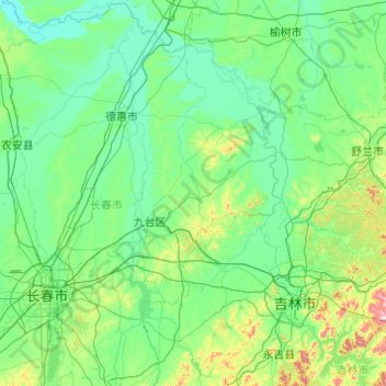
Name: 九台区 topographic map, elevation, terrain.
Location: 九台区, 吉林省, 中国 (43.54737 125.35754 44.94737 126.75754)
Average elevation: 738 ft
Minimum elevation: 456 ft
Maximum elevation: 3,510 ft
Other topographic maps
Click on a map to view its topography, its elevation and its terrain.