
眉山市 topographic map
Interactive map
Click on the map to display elevation.
About this map
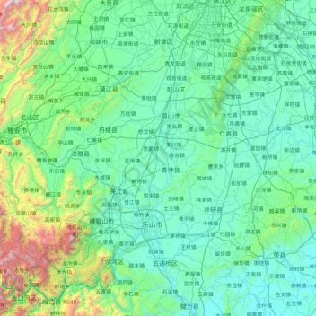
Name: 眉山市 topographic map, elevation, terrain.
Location: 眉山市, 四川省, 620400, 中国 (29.40291 102.84672 30.36444 104.50146)
Average elevation: 2,208 ft
Minimum elevation: 1,027 ft
Maximum elevation: 11,562 ft
Other topographic maps
Click on a map to view its topography, its elevation and its terrain.