
雨城区 topographic map
Interactive map
Click on the map to display elevation.
About this map
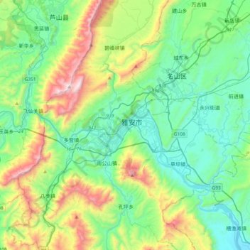
Name: 雨城区 topographic map, elevation, terrain.
Location: 雨城区, 雅安市, 四川省, 625000, 中国 (29.84846 102.87053 30.16846 103.19053)
Average elevation: 2,858 ft
Minimum elevation: 1,624 ft
Maximum elevation: 6,325 ft
Other topographic maps
Click on a map to view its topography, its elevation and its terrain.