
麒麟区 topographic map
Interactive map
Click on the map to display elevation.
About this map
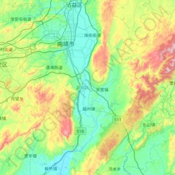
Name: 麒麟区 topographic map, elevation, terrain.
Location: 麒麟区, 曲靖市, 云南省, 中国 (25.11805 103.65288 25.60869 104.22111)
Average elevation: 6,768 ft
Minimum elevation: 6,017 ft
Maximum elevation: 8,907 ft
Other topographic maps
Click on a map to view its topography, its elevation and its terrain.
西双版纳热带植物园-百竹园
西双版纳热带植物园-百竹园, 勐仑镇, 勐腊县, 西双版纳傣族自治州, 云南省, 666100, 中国
Average elevation: 1,834 ft