
Taney County topographic map
Interactive map
Click on the map to display elevation.
About this map
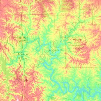
Name: Taney County topographic map, elevation, terrain.
Location: Taney County, Missouri, United States (36.49783 -93.31534 36.81680 -92.76499)
Average elevation: 997 ft
Minimum elevation: 617 ft
Maximum elevation: 1,631 ft
Missouri trails, hiking, mountain biking, running and outdoor activities
Other topographic maps
Click on a map to view its topography, its elevation and its terrain.
Creve Coeur Lake
United States > Missouri > Saint Louis County > Maryland Heights
Average elevation: 492 ft