
金堂县 topographic map
Interactive map
Click on the map to display elevation.
About this map
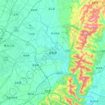
Name: 金堂县 topographic map, elevation, terrain.
Location: 金堂县, 成都市, 四川省, 610400, 中国 (30.70474 104.24950 31.02474 104.56950)
Average elevation: 1,755 ft
Minimum elevation: 1,388 ft
Maximum elevation: 3,396 ft
Other topographic maps
Click on a map to view its topography, its elevation and its terrain.