
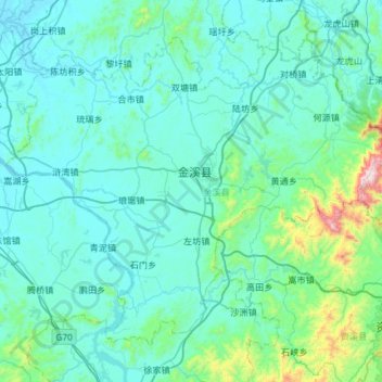
金溪县 topographic map
Interactive map
Click on the map to display elevation.
About this map
Name: 金溪县 topographic map, elevation, terrain.
Location: 金溪县, 抚州市, 江西省, 中国 (27.68278 116.45731 28.10404 117.04686)
Average elevation: 509 ft
Minimum elevation: 105 ft
Maximum elevation: 4,409 ft
金溪位于鄱阳湖平原与武夷山交界处,地势东南高西北低。最高峰出云峰,海拔1233米。
Other topographic maps
Click on a map to view its topography, its elevation and its terrain.