Geolocate

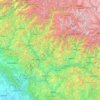
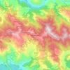
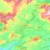
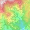
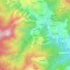
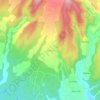
Pauri topographic map

Click on the map to display elevation.

About this map

Name: Pauri topographic map, elevation, terrain.

Location: Pauri, Pauri Garhwal, Uttarakhand, India (29.92351 78.57901 30.20694 79.03054)

Average elevation: 4,124 ft

Minimum elevation: 1,358 ft

Maximum elevation: 8,153 ft

Other topographic maps

Click on a map to view its topography, its elevation and its terrain.
Dehradun

India > Uttarakhand > Dehradun

The city of Dehradun mainly lies in Doon Valley and is at a varying height from 410 m (1,350 ft) in Clement Town to above 700 m (2,300 ft) at Malsi which is 15 km (9.3 mi) from the city. However, the average elevation is 450 m (1,480 ft) above sea level. Malsi is the starting point of Lesser Himalayan Range…

Average elevation: 2,966 ft
Dewal

India > Uttarakhand > Karnaprayag

Average elevation: 6,033 ft

Tehri-Garhwal

India > Uttarakhand

Average elevation: 7,674 ft

Chauki

India > Uttarakhand > Ghansali

Average elevation: 11,722 ft

saraikhet

India > Uttarakhand > Dhoomakot

Average elevation: 6,106 ft

Lohaghat

India > Uttarakhand > Lohaghat

Average elevation: 5,640 ft

Nainital

India > Uttarakhand > Nainital

The city of Nainital covers a total area of 11.73 km2 (4.53 sq mi), and is located at 29°23′N 79°27′E / 29.38°N 79.45°E / 29.38; 79.45, at an average elevation of 2,084 metres (6,837 ft) above sea level. The slopes of the nearby mountains are most populated, with an elevation ranging from…

Average elevation: 5,948 ft
Maldevta

India > Uttarakhand > Dehradun

Average elevation: 2,789 ft

Uttarkashi

India > Uttarakhand > Bhatwari

It is the district headquarters of Uttarkashi district. Uttarkashi is situated on the banks of river Bhagirathi at an altitude of 1158 m above sea level. Uttarkashi is generally known as a holy town close to Rishikesh. It is located in the state of Uttarakhand in India. Uttarkashi is home to a number of…

Average elevation: 5,312 ft
Bhowali

India > Uttarakhand > Nainital

Bhowali (Kumaoni: Bhoāli)[bʱəʋaːli] is a town and municipal board in Nainital District in the state of Uttarakhand, India. It is situated at a distance of 11 km (6.8 mi) from the city of Nainital, the district headquarters; at an average elevation of 1,654 m (5,427 ft) from sea level. It is the seat of…

Average elevation: 5,486 ft
Rishikesh

India > Uttarakhand > Rishikesh

Rishikesh is at 30°06′12″N 78°17′41″E / 30.103368°N 78.294754°E / 30.103368; 78.294754. It has an average elevation of 340 metres (1,120 ft). The town is located in the Tehri Garhwal region of the northern Indian state of Uttarakhand.

Average elevation: 1,631 ft
Chamoli

India > Uttarakhand

Average elevation: 11,391 ft

Mussoorie

India > Uttarakhand > Dehradun

Mussoorie is at an average altitude of 2,005 metres (6,578 ft). To the northeast are the Himalayan snow ranges, and to the south, the Doon Valley and Shiwalik ranges. The second highest point is the original Lal Tibba in Landour, with a height of over 2,275 m (7,464 ft). Mussoorie is popularly known as The…

Average elevation: 5,230 ft
Tehri Dam

India > Uttarakhand > Tehri > Bhagirathipuram

Average elevation: 2,969 ft

Ghatti

India > Uttarakhand > Bhikiasain

Average elevation: 4,800 ft

Dehra Dūn

India > Uttarakhand

Average elevation: 4,055 ft

Rāni Pokhri

India > Uttarakhand

Average elevation: 1,903 ft

Lansdowne

India > Uttarakhand > Lansdowne

Lansdowne is a quaint hill station in the Pauri Garhwal district of Uttarakhand, India. Lodged in the picturesque surroundings of the Himalayan ranges, it lies at an elevation of approximately 1,700 meters (5,577 feet) above sea level. The town is about 45 kilometers (28 miles) from the district headquarters,…

Average elevation: 3,740 ft
Garhwāl

India > Uttarakhand

Average elevation: 8,599 ft

Thalisain

India > Uttarakhand > Thailisain

Average elevation: 5,951 ft

Hemkund

India > Uttarakhand > Joshimath Tehsil

Average elevation: 14,327 ft

Bisauna

India > Uttarakhand > Gairsain > Bisauna

Average elevation: 7,792 ft

Saklana

India > Uttarakhand > Jakholi

Average elevation: 5,472 ft

Dharali

India > Uttarakhand > Bhatwari

Average elevation: 9,767 ft

Sartali

India > Uttarakhand > Dunda

Average elevation: 5,823 ft

Banbasa

India > Uttarakhand > Purnagiri

Average elevation: 741 ft

Binakot

India > Uttarakhand > Betalghat

Average elevation: 4,957 ft

Roorki

India > Uttarakhand > Kaladhungi

Average elevation: 2,290 ft

Pauri

India > Uttarakhand > Dunda

Average elevation: 5,512 ft

Batrojkhan

India > Uttarakhand > Betalghat

Average elevation: 4,987 ft

Dhumakot

India > Uttarakhand > Dhoomakot

Average elevation: 5,266 ft

Chopta

India > Uttarakhand > Rudraprayag

Average elevation: 4,639 ft

Narkota

India > Uttarakhand > Rudraprayag > Narkota

Average elevation: 3,038 ft

Kalwa

India > Uttarakhand > Dunda

Average elevation: 7,234 ft

Panwali Kantha

India > Uttarakhand > Jakholi

Average elevation: 9,813 ft

Rampur

India > Uttarakhand > Kalsi > Singhori

Average elevation: 5,876 ft

Chhali

India > Uttarakhand > Jakholi

Average elevation: 5,404 ft

Bhadraj

India > Uttarakhand > Kalsi

Average elevation: 4,117 ft

Matkot

India > Uttarakhand > Gairsain

Average elevation: 5,909 ft

Silogi

India > Uttarakhand > Lansdowne

Average elevation: 4,859 ft

kaintholi

India > Uttarakhand > Jakhani Dhar > anjanisain

Average elevation: 5,548 ft

Sangliya

India > Uttarakhand > Dhoomakot

Average elevation: 4,944 ft

Haldukhal

India > Uttarakhand > Dhoomakot

Average elevation: 3,550 ft

Pithoragarh

India > Uttarakhand > Pithoragarh Tehsil

Pithoragarh is located at 29°35′N 80°13′E / 29.58°N 80.22°E / 29.58; 80.22. in the district of Pithoragarh, Uttarakhand, India. It lies in the revenue Division of Kumaon and is located 188 km northeast of Nainital, the administrative headquarters of Kumaon. It has an average elevation of 1,627…

Average elevation: 5,305 ft
Badrinath

India > Uttarakhand > Joshimath Tehsil

Average elevation: 13,294 ft

Rikhnikhal

India > Uttarakhand > Dhoomakot

Average elevation: 4,472 ft

Padampur Padlia

India > Uttarakhand > Haldwani > Lamachaur

Average elevation: 1,109 ft

Dhārchula

India > Uttarakhand > Dharchula Tehsil

Average elevation: 5,180 ft

Mewār

India > Uttarakhand > Lansdowne > Parshulikhal

Average elevation: 4,088 ft

Shyamkhet

India > Uttarakhand > Nainital

Average elevation: 5,797 ft

Agrora

India > Uttarakhand > Lansdowne

Average elevation: 4,984 ft

Gunji

India > Uttarakhand > Dharchula Tehsil

Average elevation: 11,962 ft

George Everest Peak

India > Uttarakhand > Dehradun > charlevila

Average elevation: 5,886 ft

Sitapur

India > Uttarakhand > Ukhimath

Average elevation: 6,765 ft

satkhol

India > Uttarakhand > Kosya Kutauli

Average elevation: 5,591 ft

Kuleti

India > Uttarakhand > Nainital

Average elevation: 6,322 ft

Taknaur Renge

India > Uttarakhand > Bhatwari

Average elevation: 5,942 ft

pakhri

India > Uttarakhand > Ranikhet

Average elevation: 3,888 ft

Nakuri

India > Uttarakhand > Garud

Average elevation: 5,351 ft

Bhujyura

India > Uttarakhand > Bhanoli > Siroda

Average elevation: 6,526 ft

Roorkee

India > Uttarakhand > Roorkee

Roorkee is located at 29°52′N 77°53′E / 29.87°N 77.88°E / 29.87; 77.88. It has an average elevation of 268 metres (879 ft).

Average elevation: 886 ft
Kedarnath

India > Uttarakhand > Ukhimath

Average elevation: 13,806 ft

Khopi

India > Uttarakhand > Nainital > Bhumiyadhar

Average elevation: 5,433 ft

Chaukhuta

India > Uttarakhand > Dhari > Kasiyalekh

Average elevation: 6,440 ft

Haldwani

India > Uttarakhand > Haldwani

Haldwani is located at 29°13′N 79°31′E / 29.22°N 79.52°E / 29.22; 79.52, in the Nainital district on the right bank of the Gaula River. Geologically, Haldwani is settled on a piedmont grade (called Bhabhar) where the mountain rivers go underground to re-emerge in the Indo-Gangetic Plain. The…

Average elevation: 1,683 ft
Binak

India > Uttarakhand > Yamkeshwar

Average elevation: 3,130 ft

Mohanchatti

India > Uttarakhand > Yamkeshwar

Average elevation: 2,441 ft

Ranchula

India > Uttarakhand > Yamkeshwar > Thunda

Average elevation: 3,363 ft

Dhapa

India > Uttarakhand > Munsiari tehsil > Darkot

Average elevation: 6,309 ft

Almora

India > Uttarakhand > Almora

Almora is located at 29°35′50″N 79°39′33″E / 29.5971°N 79.6591°E / 29.5971; 79.6591 in Almora district in Uttarakhand. Almora is situated 365 km north-east the national capital New Delhi and 415 km south-east the state capital Dehradun. It lies in the revenue Division Kumaon and is located…

Average elevation: 5,108 ft
Bhatwari

India > Uttarakhand > Bhatwari

Average elevation: 6,690 ft

Munsyari

India > Uttarakhand > Munsiari tehsil

Average elevation: 7,566 ft

Pundrasu

India > Uttarakhand > Yamkeshwar

Average elevation: 2,828 ft

Roopkund Lake

India > Uttarakhand > Chamoli Tehsil

Roopkund (locally known as Mystery Lake or Skeleton Lake) is a high altitude glacial lake in the Uttarakhand state of India. It lies in the lap of Trishul massif. Located in the Himalayas, the area around the lake is uninhabited and is roughly at an altitude of 5,020 metres (16,470 ft), surrounded by…

Average elevation: 15,194 ft
Chorabari Glacier

India > Uttarakhand > Ukhimath > Kedarnath

Average elevation: 16,440 ft

Lake Vasuki Tal

India > Uttarakhand > Ukhimath > Kedarnath

Average elevation: 14,117 ft

Dudori

India > Uttarakhand > Syalde > Kaljipa

Average elevation: 5,131 ft

Bajwad

India > Uttarakhand > Garud

Average elevation: 5,758 ft

Jhimar

India > Uttarakhand > Molekhal

Average elevation: 5,456 ft

simoli

India > Uttarakhand > Ranikhet

Average elevation: 5,167 ft

Kyarkoti Lake

India > Uttarakhand > Bhatwari

Average elevation: 13,264 ft

kamoli

India > Uttarakhand > Kosya Kutauli > suyalbari

Average elevation: 4,180 ft

Paukhal

India > Uttarakhand > Dhanaulti

Average elevation: 3,593 ft

silyara

India > Uttarakhand > Ghansali

Average elevation: 3,947 ft

Khadi Malli

India > Uttarakhand > Narendra Nagar > Chiriyali

Average elevation: 3,839 ft

Deghat

India > Uttarakhand > Syalde

Average elevation: 3,698 ft

Dunagiri

India > Uttarakhand > Joshimath Tehsil

Average elevation: 19,879 ft

Durmi

India > Uttarakhand > Chamoli Tehsil

Average elevation: 6,873 ft

halai

India > Uttarakhand > Chaubatta Khal > Simalkhal

Average elevation: 4,885 ft

Bagi

India > Uttarakhand > Tehri

Average elevation: 6,234 ft

Bajan

India > Uttarakhand > Tyuni

Average elevation: 5,587 ft

Pujargaon

India > Uttarakhand > Ghansali > Ghuttu

Average elevation: 6,227 ft

Bangoli

India > Uttarakhand > Dhanaulti

Average elevation: 5,997 ft

sarun

India > Uttarakhand > Ghansali > Akhori

Average elevation: 5,650 ft

Gauchar

India > Uttarakhand > Karnaprayag

Gauchar (Garhwali: Gòchàr ) is a Hill Town sort of a valley town located in Karnaprayag tehsil within Chamoli district of Uttarakhand state in India. Gauchar is situated on the left bank of river Alaknanda and is en route to the celebrated holy destination of Badrinath. It is well known for being one of the…

Average elevation: 3,924 ft

Binsar

India > Uttarakhand > Almora

Average elevation: 6,391 ft

anuli

India > Uttarakhand > Lamgara Tehsil

Average elevation: 5,827 ft

Bidholi

India > Uttarakhand > Vikasnagar

Average elevation: 2,415 ft

Malari

India > Uttarakhand > Joshimath Tehsil

Average elevation: 11,345 ft

Gagas

India > Uttarakhand > Bhikiasain > Bhikia Sain > Saboli Rautela

Average elevation: 2,979 ft

Gear up for your next adventure:

🦺Reflective Outdoor Gear - Safety gear for low‑light conditions
📦Dry Bags Set - Waterproof storage for electronics and clothes
🧯Portable Fire Pit - Compact fire pit for camping spots
🏔️Mountain Trail Maps - High‑detail maps for popular peaks
🔦Powerful Headlamps - Ultra-bright hands-free lighting for night navigation

As an Amazon Associate, this site earns from qualifying purchases at no extra cost to you.