
襄阳市 topographic map
Interactive map
Click on the map to display elevation.
About this map
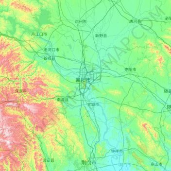
Name: 襄阳市 topographic map, elevation, terrain.
Location: 襄阳市, 湖北省, 中国 (31.23051 110.75843 32.63705 113.11554)
Average elevation: 991 ft
Minimum elevation: 118 ft
Maximum elevation: 6,198 ft
Other topographic maps
Click on a map to view its topography, its elevation and its terrain.