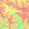
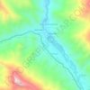
Amnu topographic map
Click on the map to display elevation.
About this map

Name: Amnu topographic map, elevation, terrain.
Location: Amnu, Kargil district, Ladakh, India (33.24728 77.07278 33.24827 77.07407)
Average elevation: 13,402 ft
Minimum elevation: 12,293 ft
Maximum elevation: 15,203 ft
Other topographic maps
Click on a map to view its topography, its elevation and its terrain.


Leh
Leh (/ˈlɛ/) (Ladakhi: གླེ) is the joint capital and largest city of Ladakh, a union territory of India. Leh, located in the Leh district, was also the historical capital of the Kingdom of Ladakh, the seat of which was in the Leh Palace, the former residence of the royal family of Ladakh, built in the…
Average elevation: 14,088 ft

Nubra
The main road access to Nubra is over Khardung La pass which is open throughout the year. The highest elevation of Khardung La is 5,359 m (17,582 ft), its status as the highest motorable road in the world is no longer accepted by most authorities. An alternative route, opened in 2008, crosses the Wari La from…
Average elevation: 16,332 ft

Leh district
Leh is connected to the rest of India by two high-altitude roads both of which are subject to landslides and neither of which are passable in winter when covered by deep snows. The National Highway 1D from Srinagar via Kargil is generally open longer. The Leh-Manali Highway can be troublesome due to very high…
Average elevation: 16,319 ft

Chang La
Chang La is a high mountain pass in Ladakh at an elevation of 5,391.3024 m (17,688.000 ft) in the Ladakh Range between Leh and the Shyok River valley. The Chang La, on Leh to Pangong Lake road, lies on the Leh-Karu-Sakti-Zingral-Chang La-Durbuk-Tangtse-Pangong Lake motorable road. Karu, which lies on…
Average elevation: 17,927 ft



Nyoma
The airbase received the Wildlife Board's forest clearance in 2022 to expand into 508 hectare of land inside Changthang Wildlife Sanctuary. The Government of India announced in January 2023 that this airstrip will be upgraded in two years by the end of 2024 at a cost of Rs.214 crore (US$27 m) to a 1,235 acre…
Average elevation: 13,976 ft

Daulat Beg Oldi
Daulat Beg Oldi (DBO) lies at the northeastern corner of the Karakoram Range, at the northern edge of Depsang Plains at an elevation of 5,100 metres (16,700 ft). The international border with China is 8 km to the north and the Line of Actual Control with Chinese-controlled Aksai Chin is 9 km to the east. Other…
Average elevation: 16,683 ft

Kargil district old
Kargil has an average elevation of 2,676 metres (8,780 feet), and is situated along the banks of the Suru River (Indus). The town of Kargil is located 205 km (127 mi) from Srinagar, facing the Northern Areas across the LOC. Like other areas in the Himalayas, Kargil has a temperate climate. Summers are hot with…
Average elevation: 13,825 ft









Kargil
India > Ladakh > Kargil tehsil
Kargil has an average elevation of 2,676 metres (8,780 feet), and is situated along the banks of the Suru River (Indus). The town of Kargil is located 205 km (127 mi) from Srinagar, facing the Northern Areas across the LOC. Like other areas in the Himalayas, Kargil has a temperate climate. Summers are hot with…
Average elevation: 10,702 ft

Khardung La
India > Ladakh > Leh Tehsil
The elevation of Khardung La is 5,359 m (17,582 ft). Local summit signs and dozens of stores selling shirts in Leh incorrectly claim that its elevation is in the vicinity of 5,602 m (18,379 ft)} and that it is the world's highest motorable pass. But in 2013-2014, Chisumle-Demchok Road via Umling La (19,300…
Average elevation: 17,175 ft
Zanskar
Zanskar covers an area of some 7,000 square kilometres (2,700 sq mi), generally at an elevation between 3,600 and 4,000 m (11,800 and 13,100 ft). It consists of the country lying along the two main branches of the Zanskar River. The first, the Doda River, has its source near the Penzi La 4,400 metres (14,400…
Average elevation: 15,630 ft




Dras
Dras (also spelt Drass, ISO transliteration: Drās), also known locally in Shina as Himababs, Hembabs, or Humas, is a town and hill station, near Kargil in the Kargil district of the union territory of Ladakh in India. It is on the NH 1 between Zoji La pass and Kargil. A tourist hub for its high-altitude…
Average elevation: 11,585 ft
Dah
India > Ladakh > Khalsi tehsil
Traveling up the Dah stream, there are several summer habitations, which the inhabitants of Dha occupy for a short time or longer depending on their elevation. While descending, the first areas to appear are Dunder, Cilgiadi, and Cumavcings, which has cultivated fields. The valley stretching along the Dah…
Average elevation: 10,830 ft


Leh
Leh (/ˈlɛ/) (Ladakhi: གླེ) is the joint capital and largest city of Ladakh, a union territory of India. Leh, located in the Leh district, was also the historical capital of the Kingdom of Ladakh, the seat of which was in the Leh Palace, the former residence of the royal family of Ladakh, built in the…
Average elevation: 14,088 ft


Kargil
Kargil has an average elevation of 2,676 m (8,780 ft), and is situated along the banks of the Suru River. The town of Kargil is located 205 km (127 mi) from Srinagar, facing Gilgit-Baltistan across the LoC. Like other areas in the Himalayas, Kargil has a temperate climate. Summers are hot with cool nights,…
Average elevation: 13,825 ft

Dras
Dras (also spelt Drass, ISO transliteration: Drās), also known locally in Shina as Himababs, Hembabs, or Humas, is a town and hill station, and the headquarters of Drass district of the union territory of Ladakh in India. It is on the NH 1 between Zoji La pass and Kargil. A tourist hub for its high-altitude…
Average elevation: 11,585 ft
Dras
Dras (also spelt Drass, ISO transliteration: Drās), also known locally as Himababs, Hembabs, or Humas, is a town, hill station and eadquarter of eponymous tehsil and community development block in Drass district of the union territory of Ladakh in India. It is on the NH 1 between Zoji La pass and Kargil town.…
Average elevation: 11,585 ft
Kargil
India > Ladakh > Kargil tehsil
Kargil has an average elevation of 2,676 m (8,780 ft), and is situated along the banks of the Suru River. The town of Kargil is located 205 km (127 mi) from Srinagar, facing Gilgit-Baltistan across the LoC. Like other areas in the Himalayas, Kargil has a temperate climate. Summers are hot with cool nights,…
Average elevation: 10,702 ft

Umling La Road highest point
Umling La or Umlung La, elevation 19,024 feet (5,799 m), is a mountain pass in the Changthang area of Ladakh, India near the village of Demchok. It is on the ridgeline that divides Koyul Lungpa and the Indus River at an elevation of 19,024 feet (5,799 m). It forms the source for the Umlung stream that drains…
Average elevation: 18,757 ft


Nyoma
The upgrade expanded the airstrip to a 1,235 acre an airbase capable of supporting fighter jet operations at 13,700 feet (4,200 m) elevation with an expanded 2.7 km (8,900 ft)-long, 46 m (151 ft)-wide runway paved runway along with allied military infrastructure. The supporting infrastructure included ATC…
Average elevation: 13,976 ft
Nyoma
The upgrade expanded the airstrip to a 1,235 acre an airbase capable of supporting fighter jet operations at 13,700 feet (4,200 m) elevation with an expanded 2.7 km (8,900 ft)-long, 46 m (151 ft)-wide runway paved runway along with allied military infrastructure. The supporting infrastructure included ATC…
Average elevation: 13,976 ft